See itineraries
  • Charming places
  • 6 days

The best of Menorca in 6 days

The itinerary for a first time in Menorca: one area a day and the essentials of each. Maó and its harbour, Binibeca and the Cova d’en Xoroi, the north of Fornells and Cavalleria, the southern coves, Ciutadella with Cala Turqueta and Punta Nati, and a last day in Macarella with sunset at Artrutx lighthouse.

Overview

Length
6 days
Activity level
Moderate walks of up to 30 minutes and one area of the island a day
Type of experience
Charming places, Beaches and coves, History and culture

Itinerary

Day 1Maó, La Mola and Cales Fonts
  1. Morning

    10:00–12:45

    Maó

  2. Midday

    13:00–15:00

    Maó

  3. Afternoon

    16:30–18:45

    Maó

  4. Evening

    19:30–22:30

    Es Castell

Days 2 to 6 are in the full itinerary

You get them when you buy, with every place card.

What you get when you buy

  1. Add it to your cart and pay by card, Apple Pay, Google Pay or other available methods. No account needed.
  2. You instantly receive an email with the link to your online itinerary: open it on your phone during the trip and mark each place as visited or not.
  3. The same email includes the PDF with every detail: times, how to get there by car or bus, where to eat, a rainy-day plan and a card for each place. It works offline.

A look inside the PDF
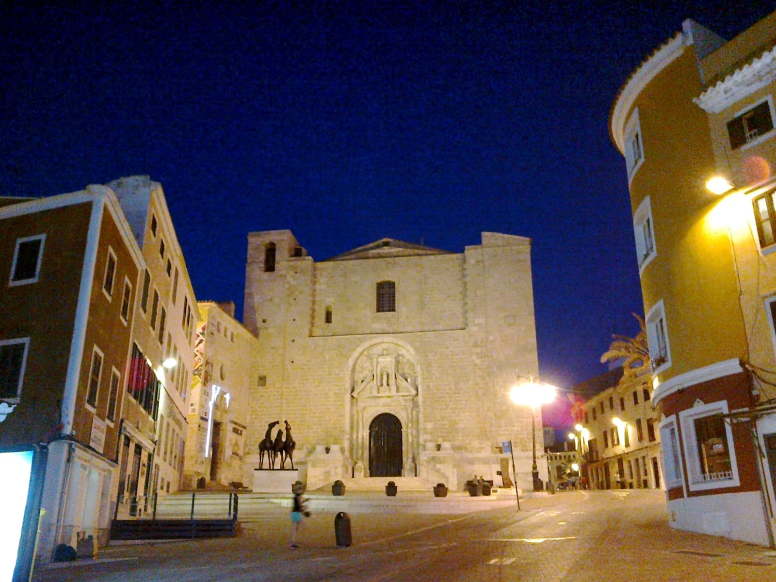
  • Cover
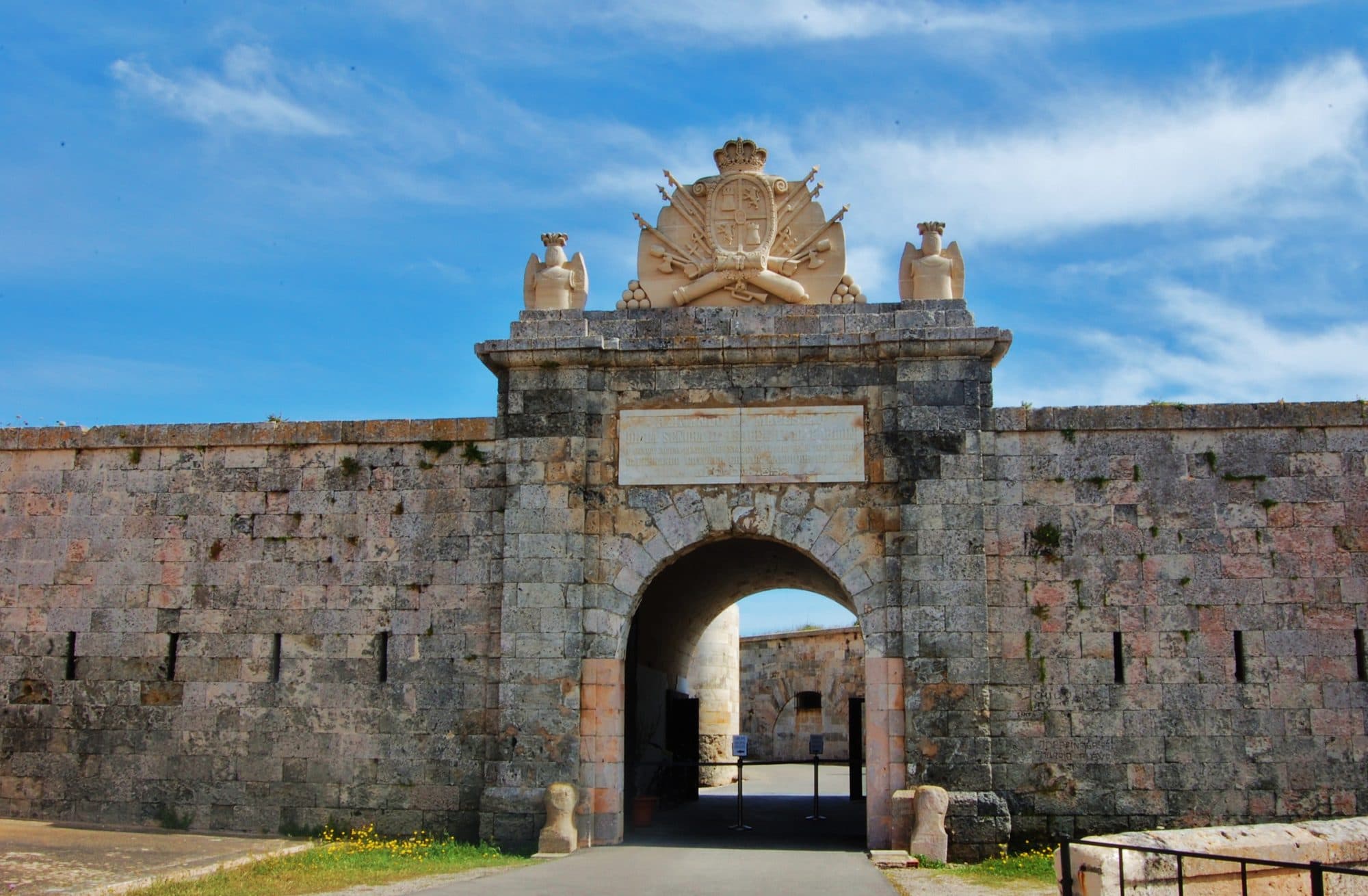
  • Each day, with times
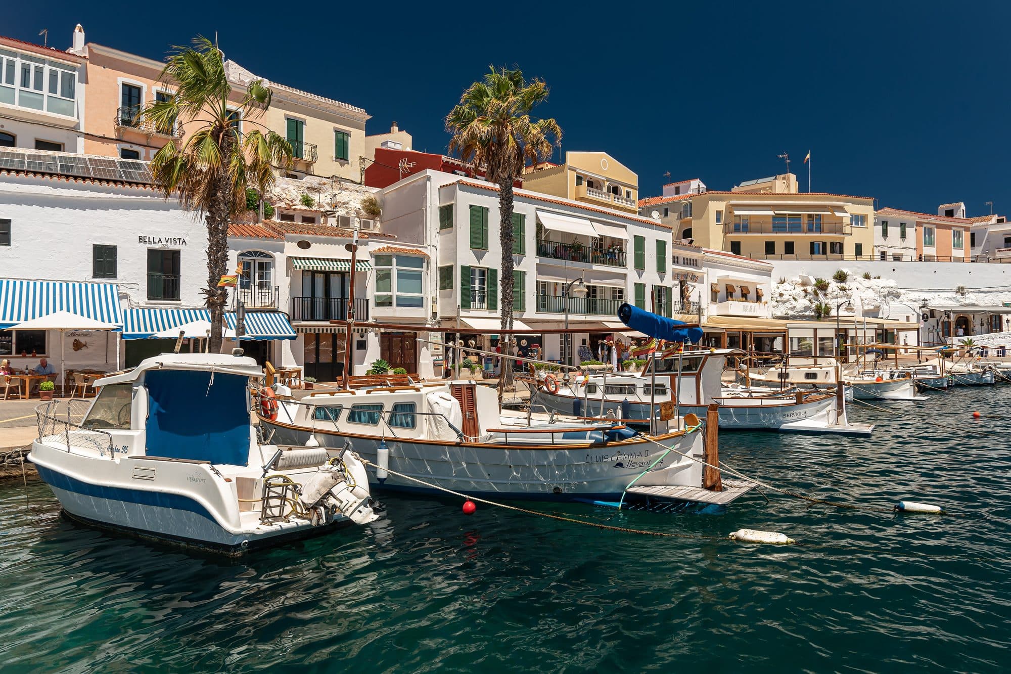
  • A card for each place
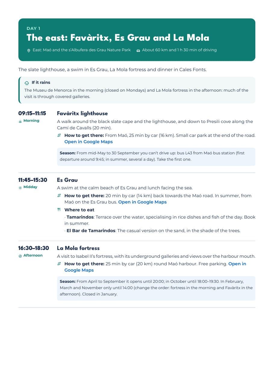
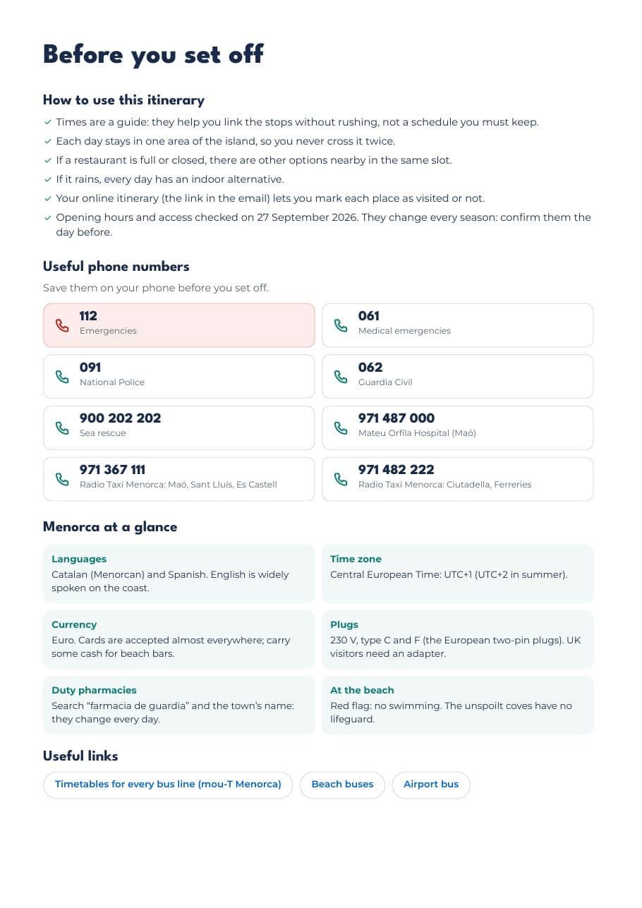
  • Phone numbers and tips
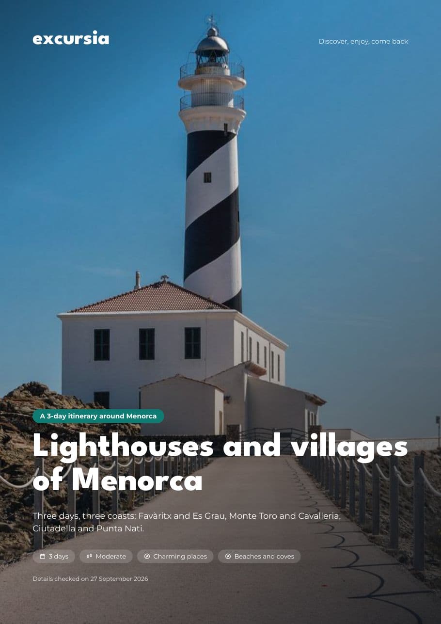
Real pages from the “Lighthouses and villages of Menorca” itinerary. Yours has the same layout, with the days and places of your route.

As digital content delivered instantly, it cannot be withdrawn from once delivered. How refunds work.

What’s included

  • A plan for every day with approximate times, from morning to night
  • Online itinerary to mark each place as visited during your trip
  • Downloadable PDF with every detail, to use offline too
  • How to get from one stop to the next: time, distance, parking and bus
  • Several places to eat in each area, in case one is full
  • An indoor alternative for rainy days
  • Summer and winter opening hours and access restrictions
  • A card for each place with the day and time of your visit, car parks and bus lines
  • Two recommended bases so you never cross the island twice in a day

Places you’ll visit

Tap a place to see its card without leaving the itinerary.
  • History and culture

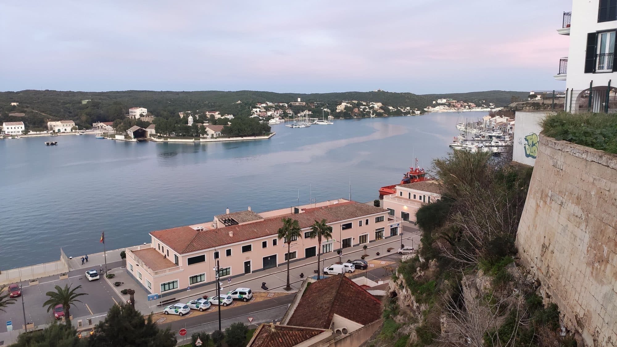
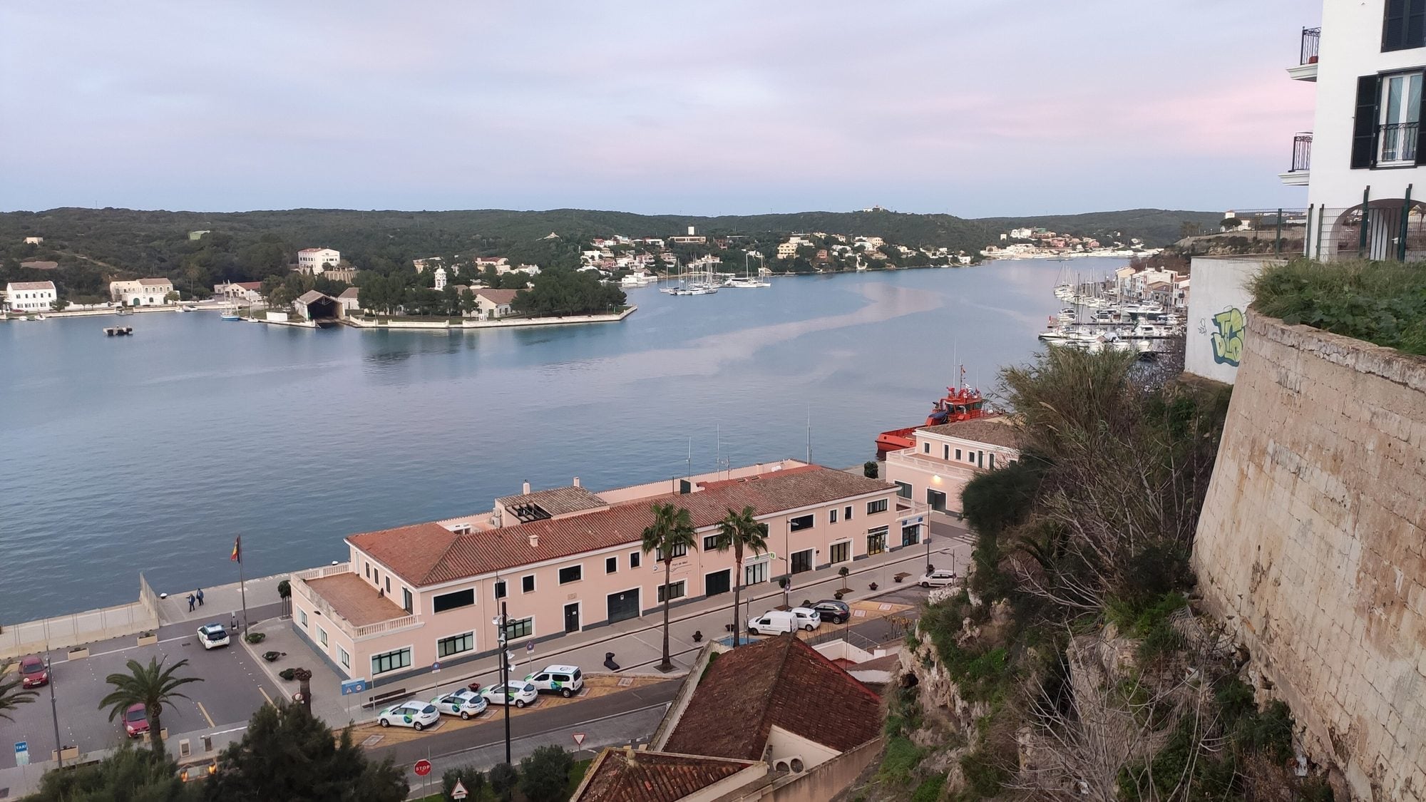
    Menorca’s capital overlooks one of the largest natural harbours in the Mediterranean. Above, the historic centre; below, the Moll de Ponent with restaurants and bars.
  • Food and local markets

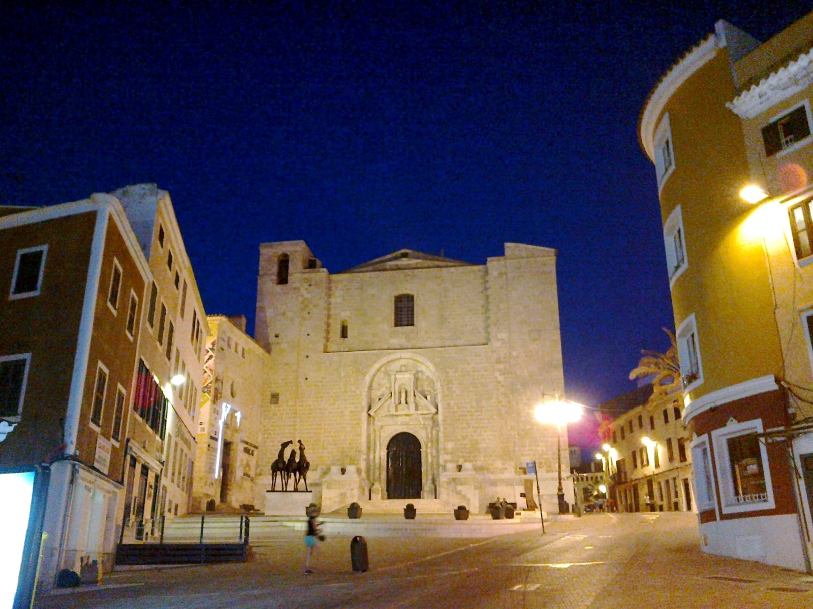
    Maó’s market, in the cloister of the former Carme convent, with stalls of local produce; next door, the fish market with tapas counters.
  • History and culture

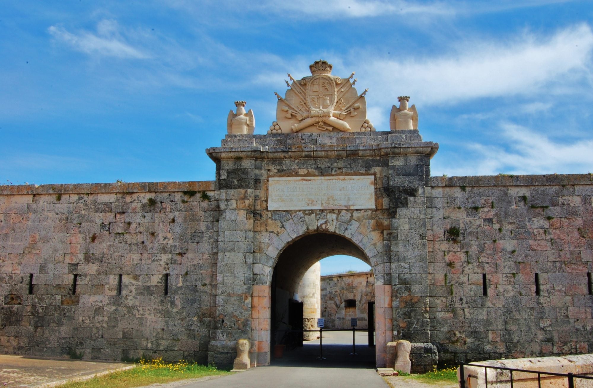
    Isabel II’s fortress, built in the 19th century to defend the entrance to Maó harbour. Underground galleries, bastions and a large Vavasseur gun at Spain’s easternmost point.
  • Charming places

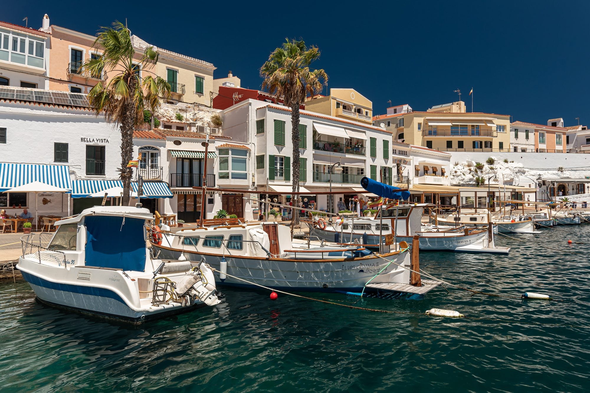
    The little harbour of Es Castell, at the mouth of Maó harbour: old fishermen’s caves turned into restaurants with tables by the water.
  • Charming places

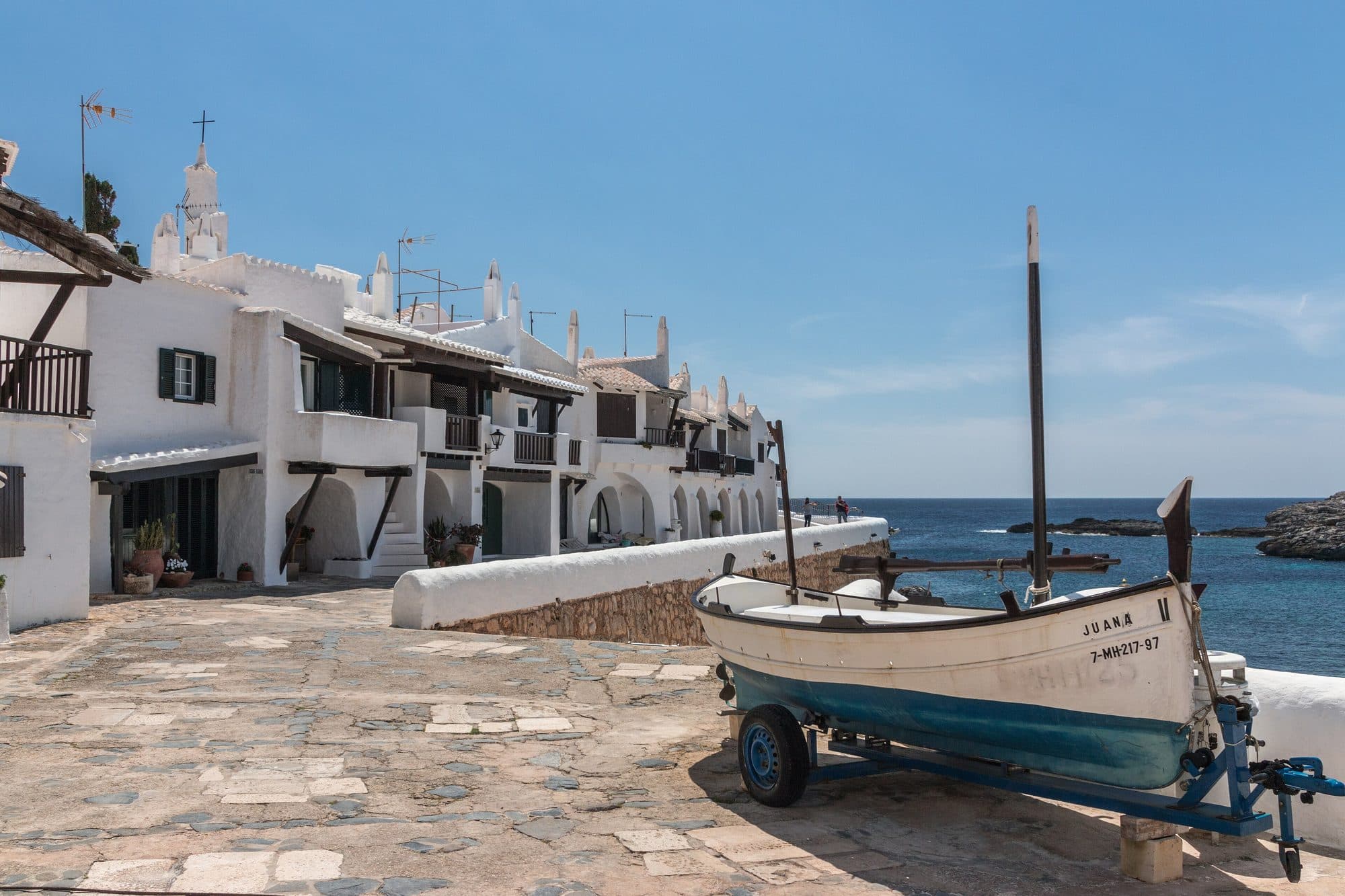
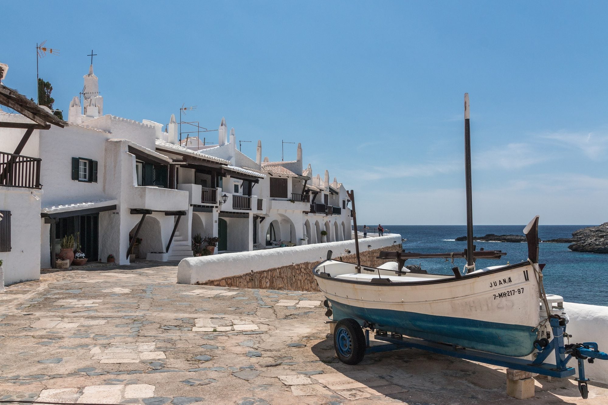
    A cluster of white houses in the style of a fishing village, built by the sea in the 1960s. Its alleys are among the most photographed in Menorca.
  • History and culture

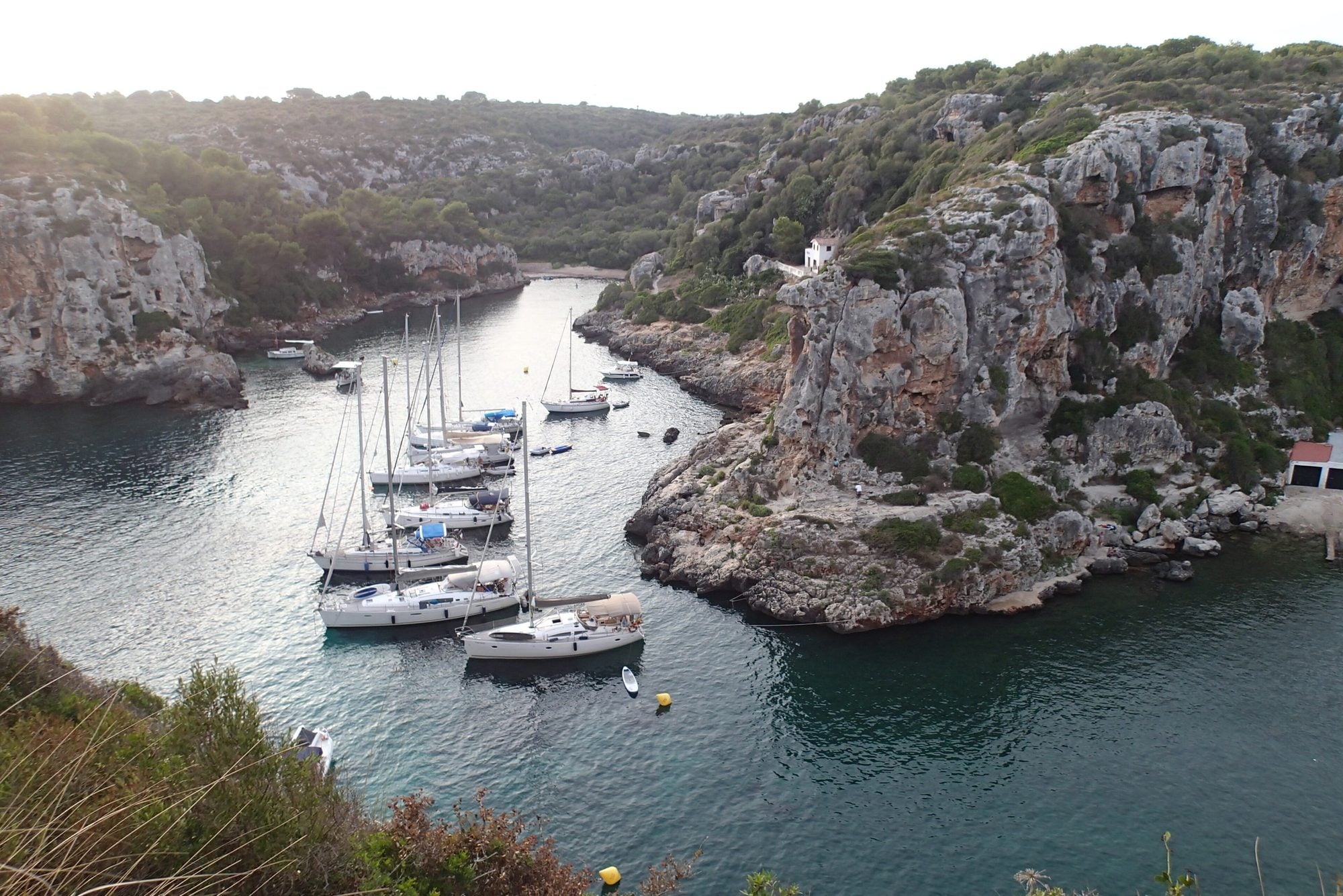
    Menorca’s largest prehistoric necropolis: about 90 burial caves carved into the cliffs of two joined coves, reached on foot.
  • Nightlife and leisure

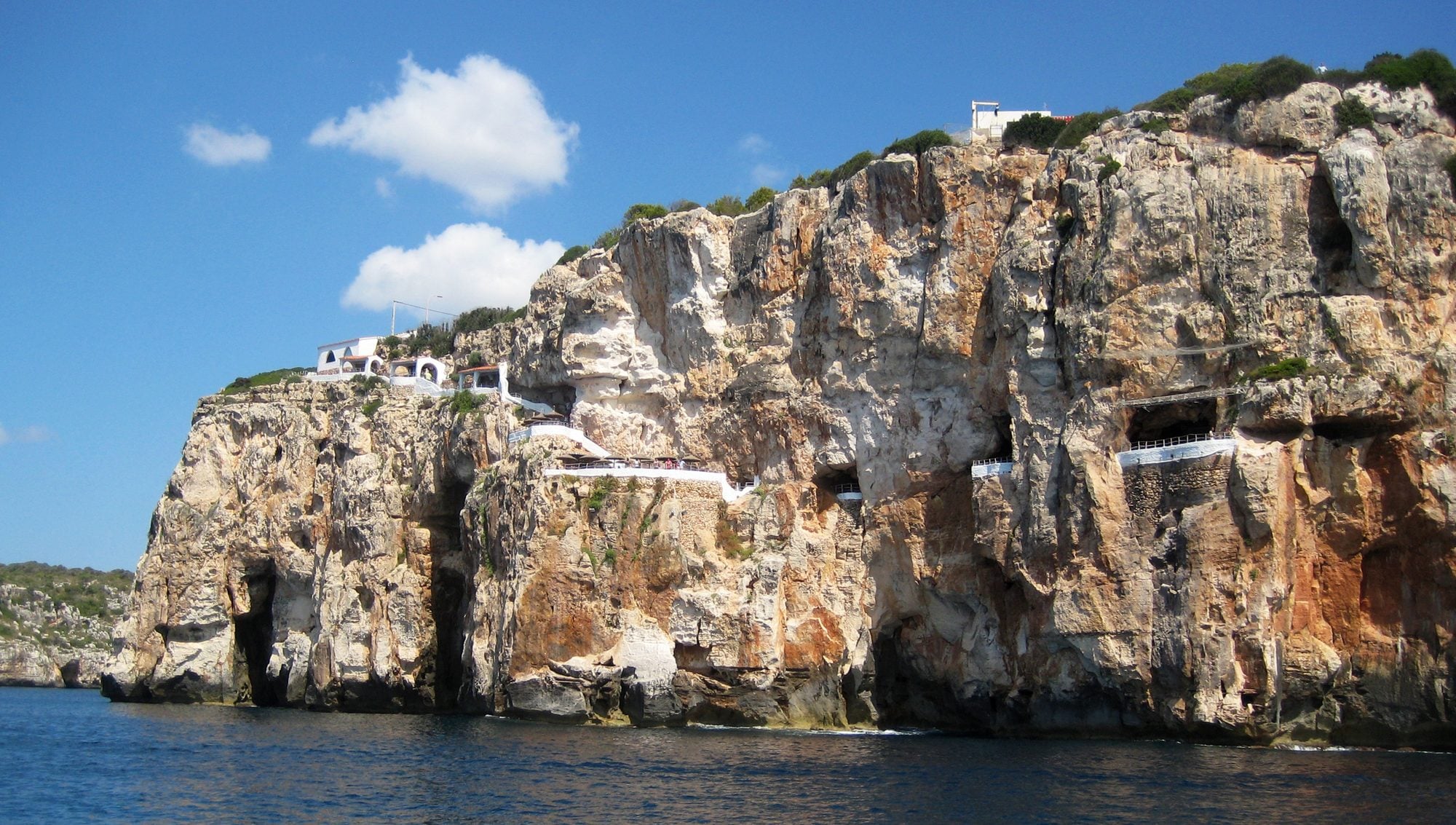
    A natural cave halfway down the Cala en Porter cliff turned into a bar with terraces over the sea to watch the sunset, and a club at night.
  • Charming places

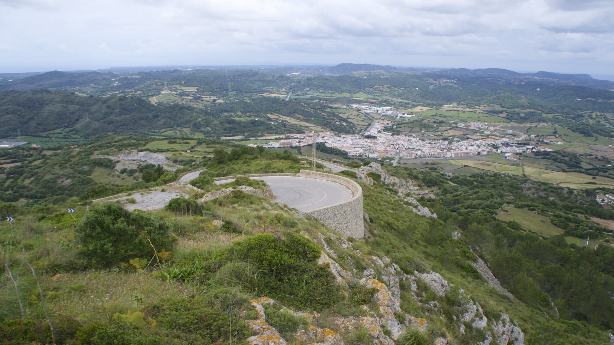
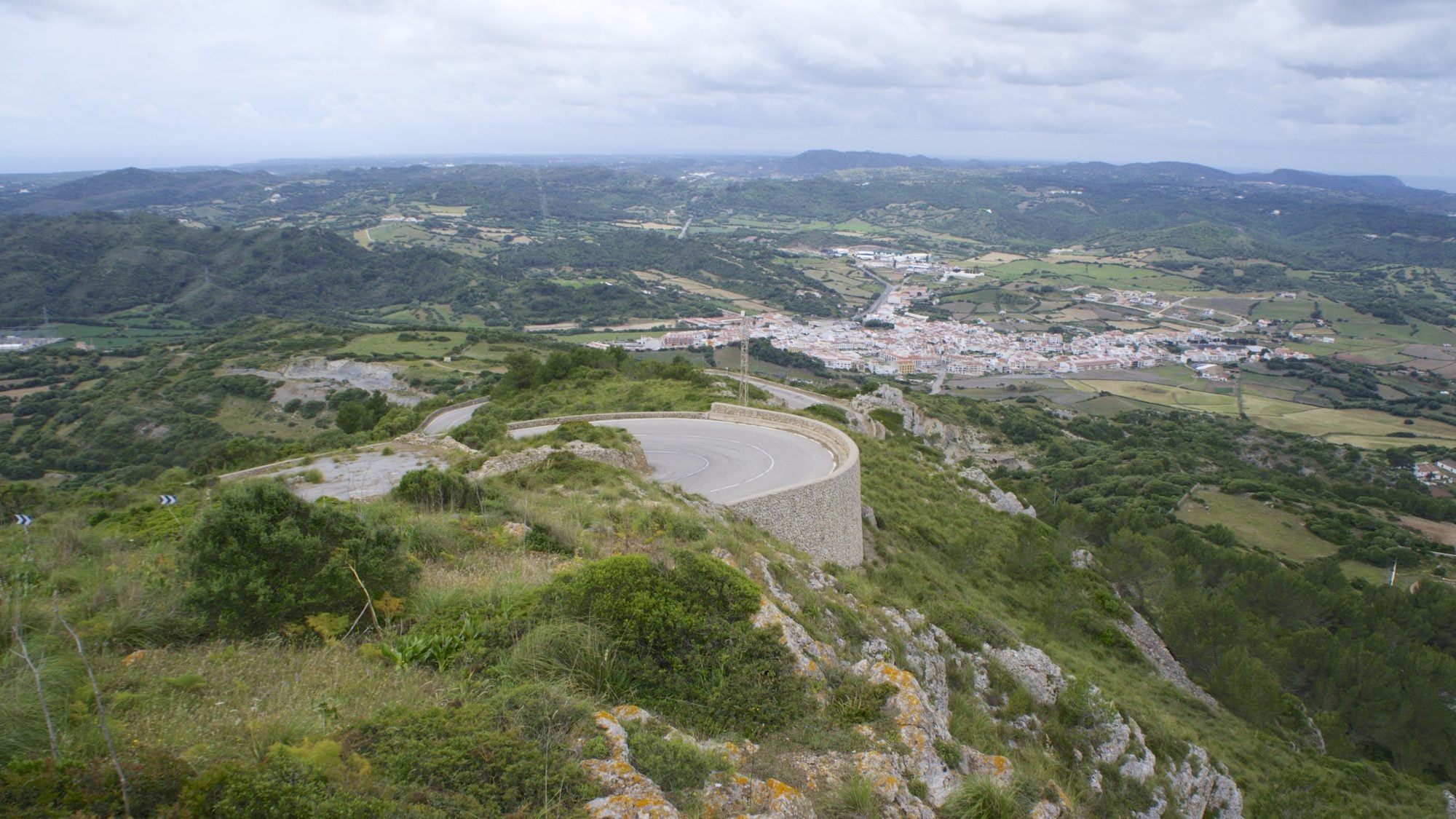
    Menorca’s highest point (358 m), in the centre of the island. At the top are the sanctuary of the Virgin of El Toro and a viewpoint from which you can see almost all of Menorca.
  • Charming places

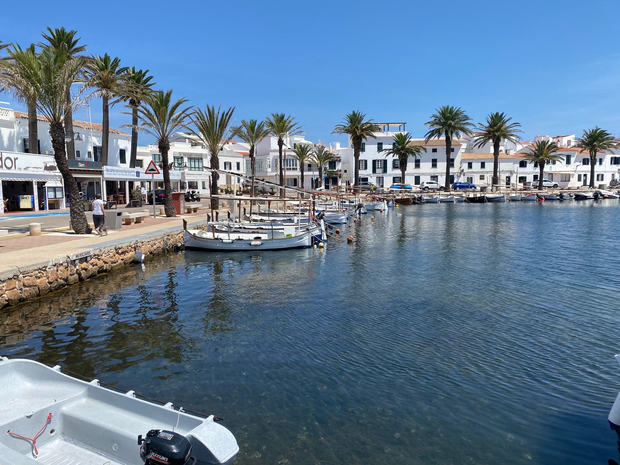
    A fishing village in the north, at the end of a large, calm bay. It’s famous for its lobster stew and its 18th-century defence tower.
  • Beaches and coves

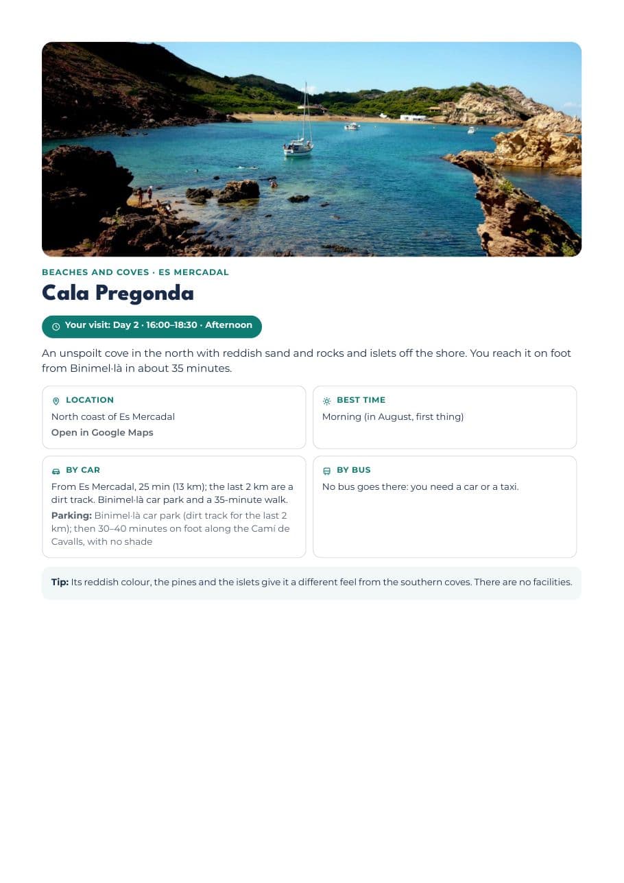
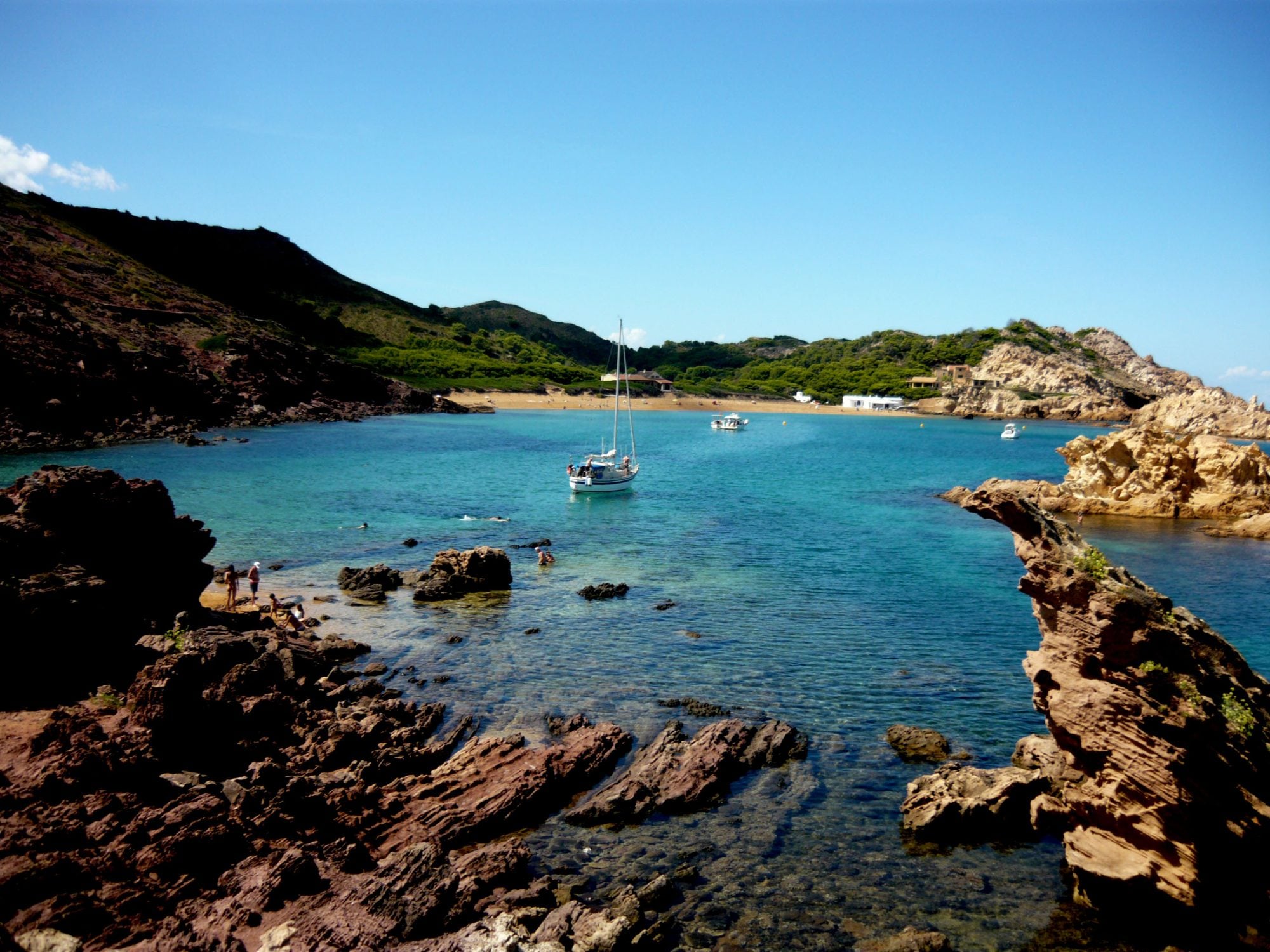
    An unspoilt cove in the north with reddish sand and rocks and islets off the shore. You reach it on foot from Binimel·là in about 35 minutes.
  • Charming places

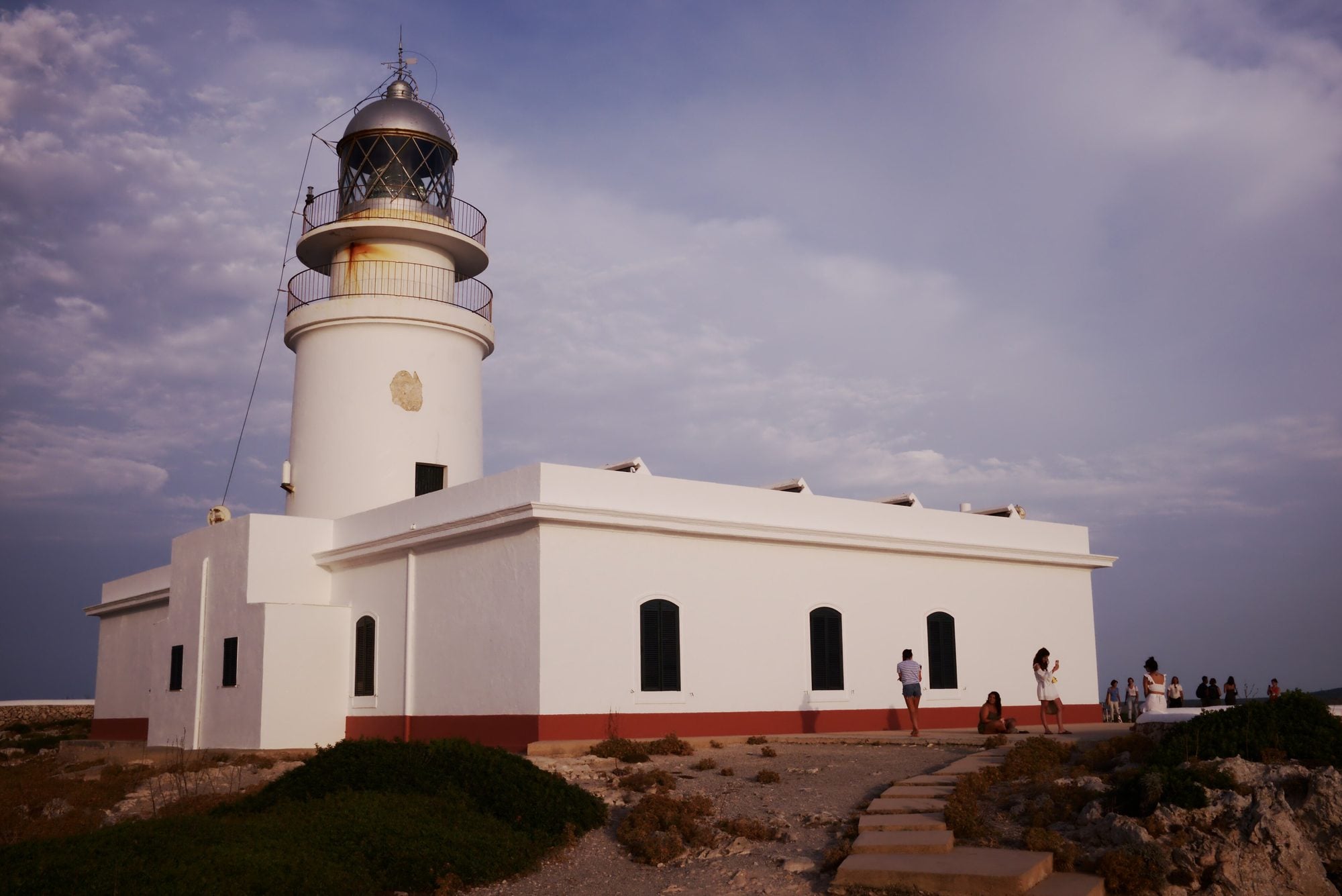
    The lighthouse at Menorca’s northernmost point, above 90-metre cliffs. From here you see the north coast, the natural harbour of Sanitja and, on clear days, Mallorca.
  • Beaches and coves

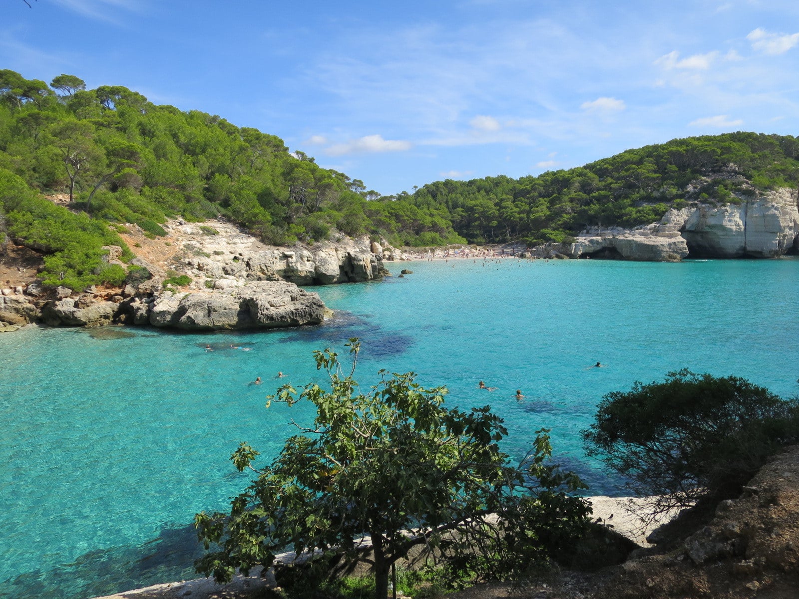
    A white-sand cove surrounded by cliffs and pines, a short walk from Cala Galdana. Much loved for its crystal-clear water.
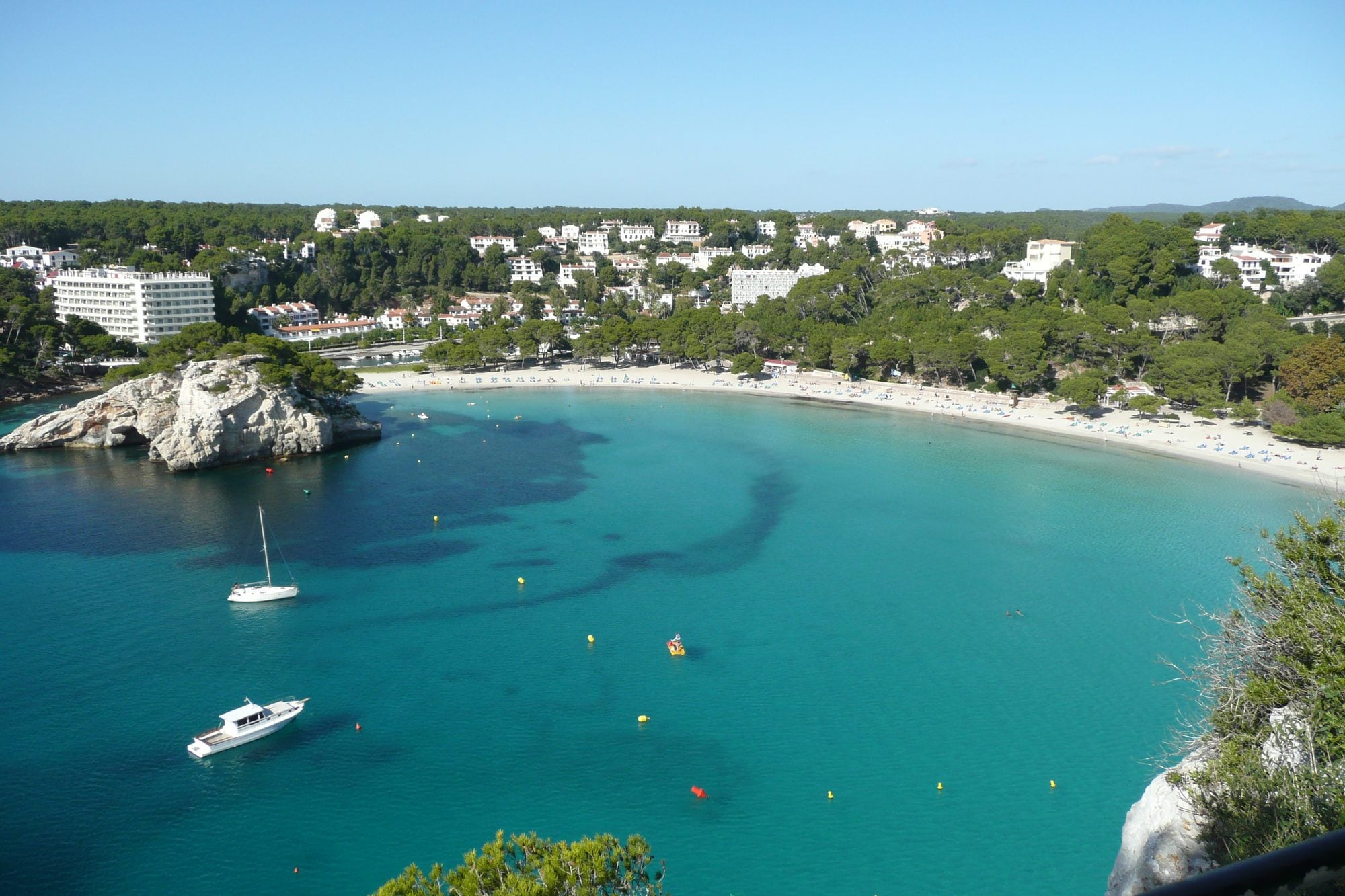
  • Beaches and coves

    A large shell-shaped cove with every facility, at the mouth of the Algendar gorge. Calm water, ideal for families.
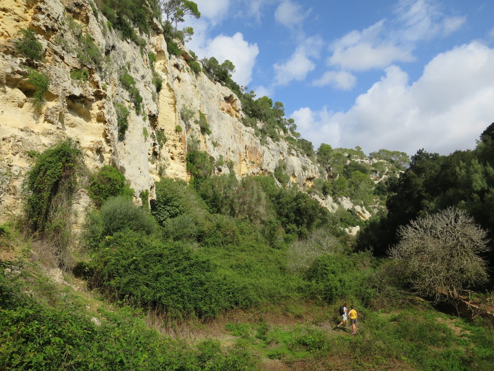
  • Nature and hiking

    One of Menorca’s longest gorges, between Ferreries and Cala Galdana: rock walls, orchards and a small stream with water almost all year.
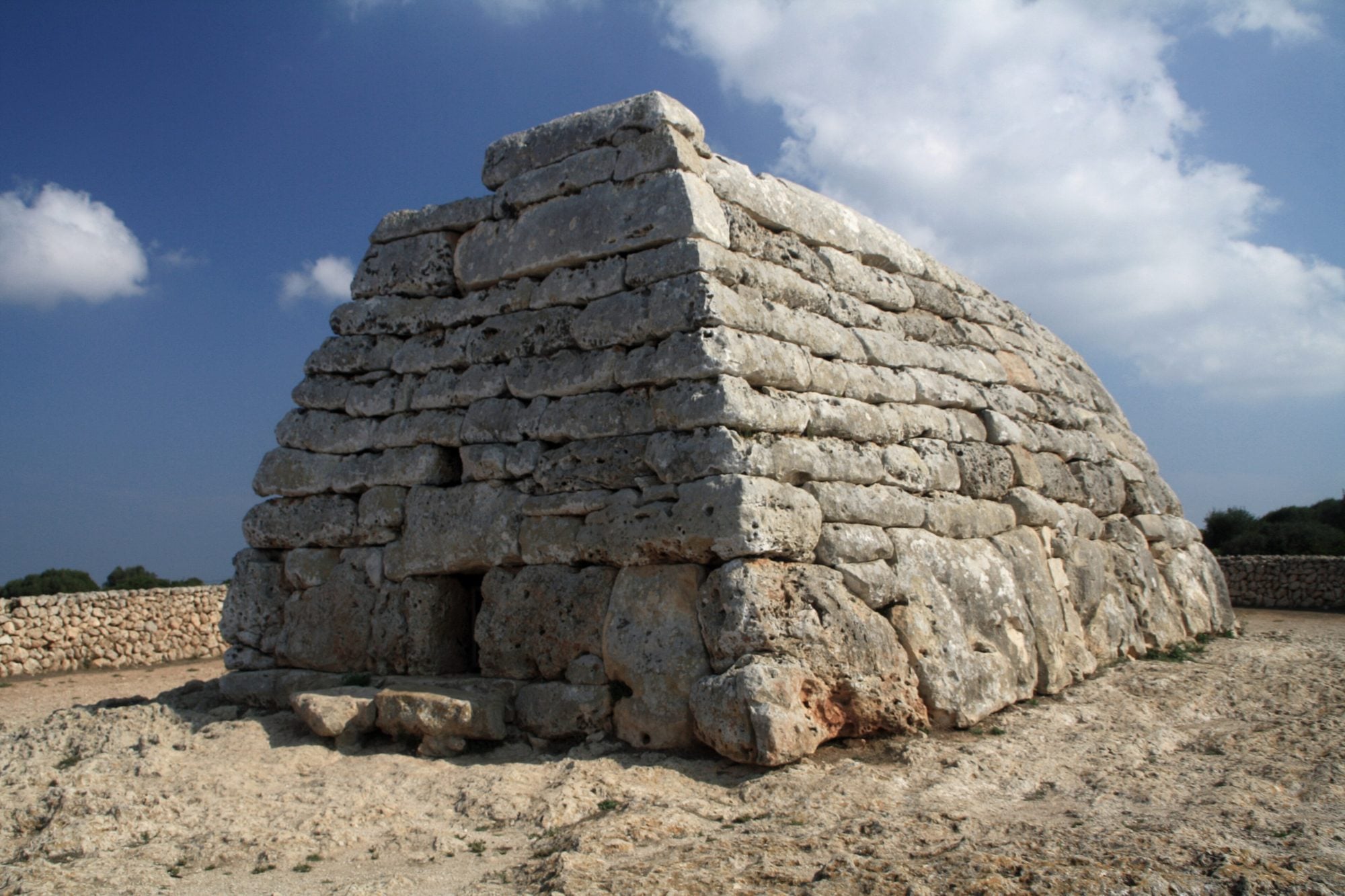
  • History and culture

    A collective tomb shaped like an upturned boat, used roughly between 1200 and 750 BC. It’s Menorca’s most emblematic prehistoric monument.
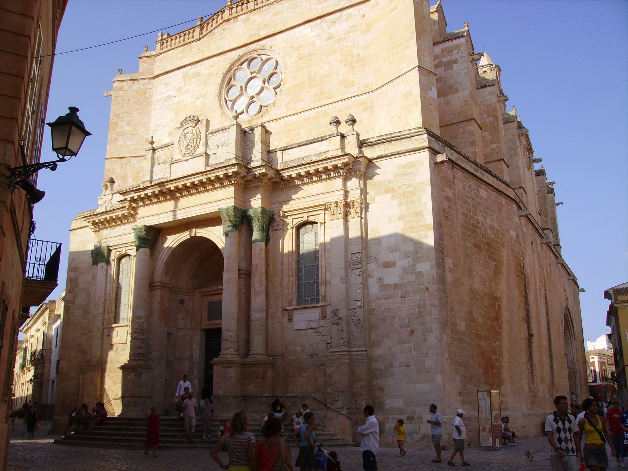
  • History and culture

    Menorca’s old capital: palaces, the Gothic cathedral, plaça des Born and the arcaded streets of Ses Voltes, all on foot within less than a kilometre.
  • Beaches and coves

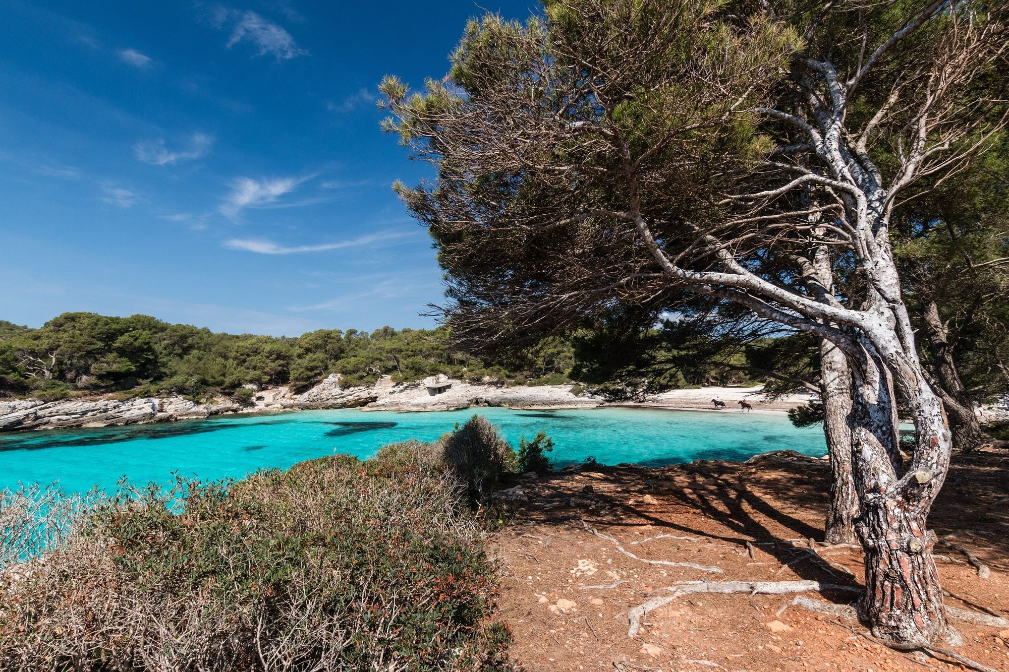
    An unspoilt cove south of Ciutadella with white sand, turquoise water and pine woods down to the shore. No buildings around it.
  • Charming places

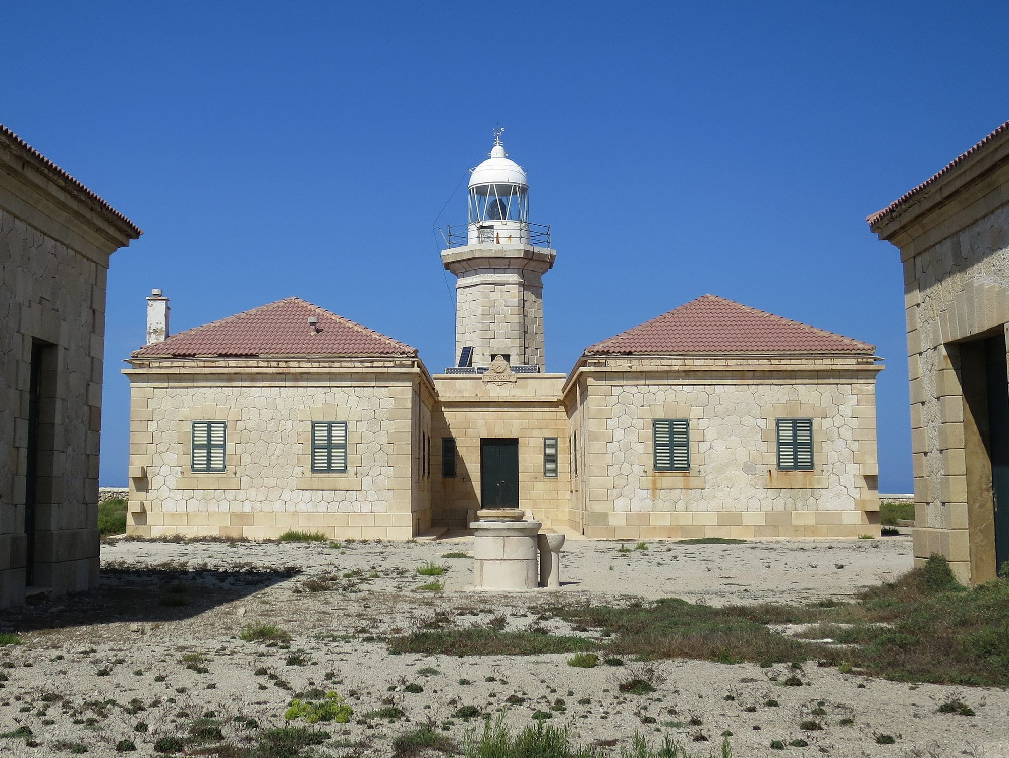
    A 1913 lighthouse on Ciutadella’s north coast, about 7 km from the centre, surrounded by a landscape of dry-stone walls. One of the island’s best sunsets.
  • Beaches and coves

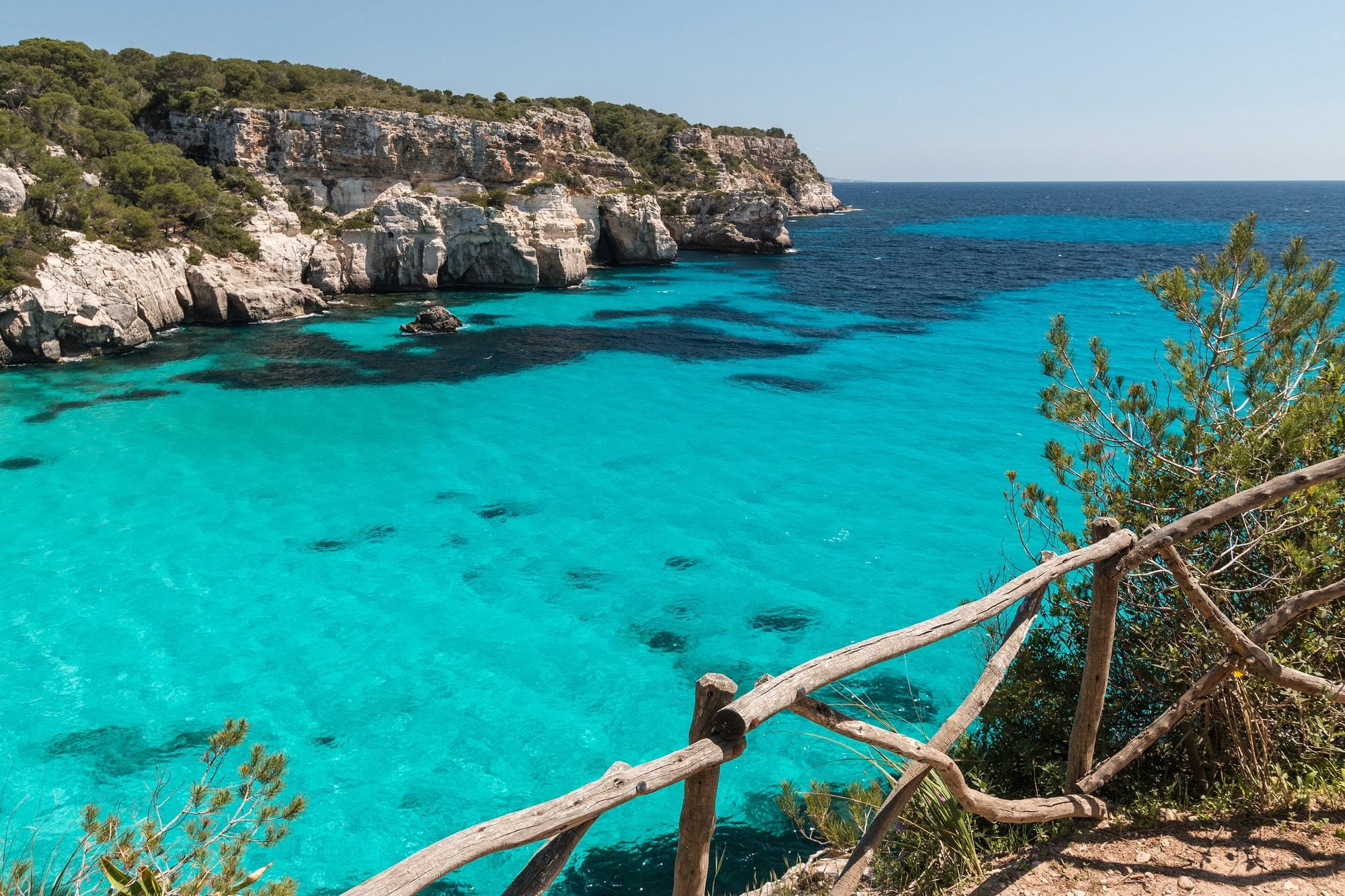
    Menorca’s most famous coves: white sand and turquoise water between cliffs and pines. Macarelleta, smaller, is 10 minutes away on foot.
  • History and culture

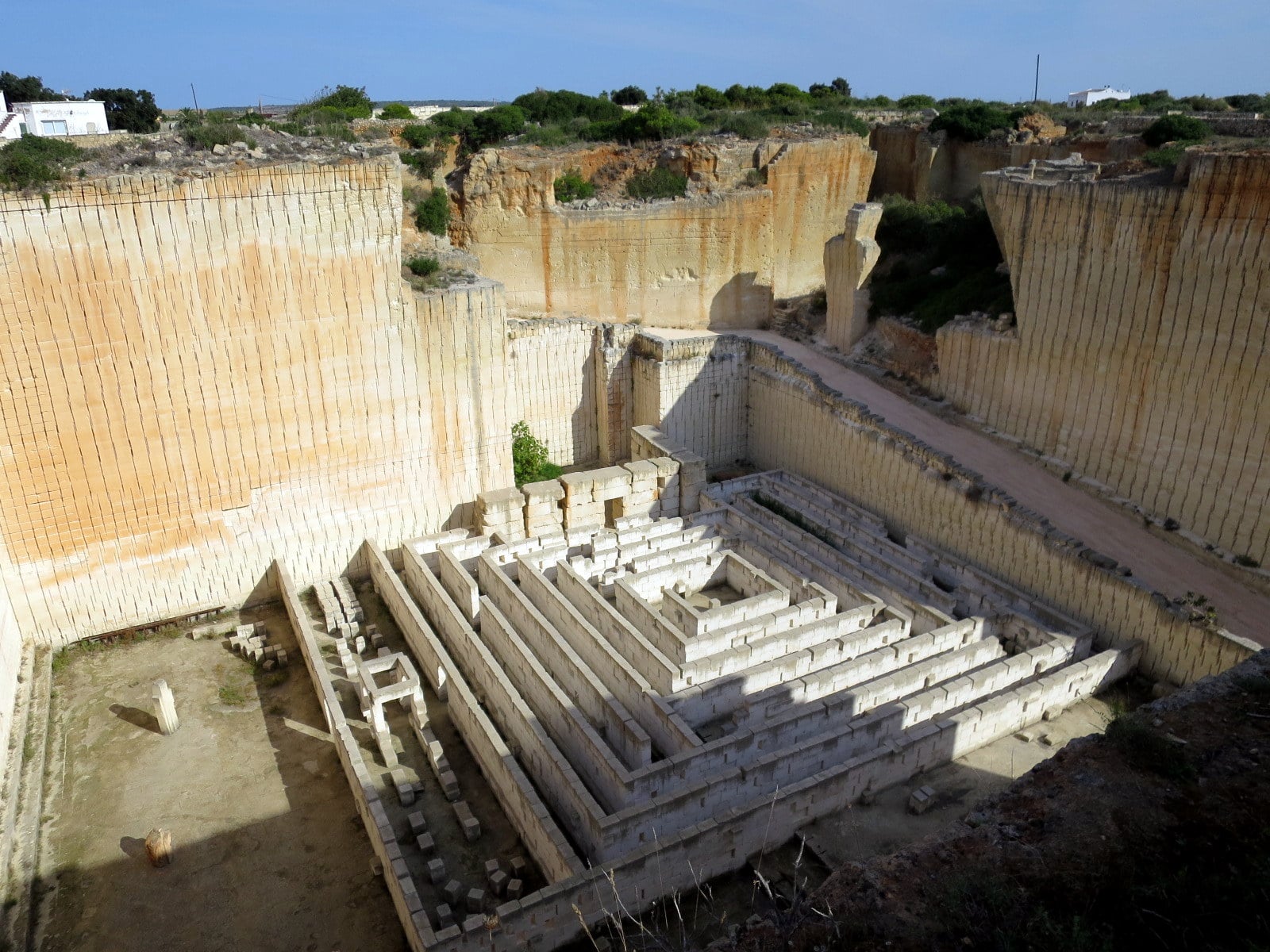
    Old marès stone quarries turned into a visitor space with labyrinths, gardens and an amphitheatre carved into the stone. They explain how Menorca was built.
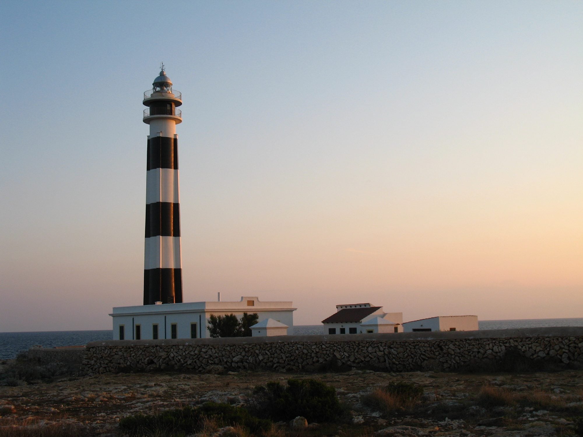
  • Charming places

    A black-and-white striped lighthouse at the south-western tip of Menorca, next to Cala en Bosc. Facing Mallorca, it’s another great spot for sunset.

Related guides

View of Maó harbour with boats and the houses on the cliff

History and culture · Maó

Maó: town centre and harbour

Menorca’s capital overlooks one of the largest natural harbours in the Mediterranean. Above, the historic centre; below, the Moll de Ponent with restaurants and bars.

What to see

Santa Maria church, with its great organ; plaça de la Constitució with the town hall; the Claustre del Carme, now a market; and the Costa de ses Voltes steps down to the harbour.

The harbour is about 5 km long, with the Illa del Rei and the Lazaretto in it. Sightseeing boats leave from the Moll de Ponent for a tour around it.

Practical information

Municipality
Maó
Location
Maó: plaça de s’Esplanada, Santa Maria church and the Moll de Ponent
Best time
All day
By car
Public car parks at the harbour and in the centre. The old town is best seen on foot.
Parking
Public car parks at the harbour and in the centre
By bus
Every line ends at Maó bus station, next to s'Esplanada square. Bus timetables: Island bus lines (opens in a new tab)

See the details

The Carme church in Maó, beside the cloister where the market is

Food and local markets · Maó

Mercat des Claustre and Mercat des Peix (Maó)

Maó’s market, in the cloister of the former Carme convent, with stalls of local produce; next door, the fish market with tapas counters.

What to taste

Mahón-Menorca cheese, sobrasada and carn i xua, ensaïmadas, and at the fish market, tapas of the day’s catch at the counters.

The cloister has a wonderful view over the harbour.

Practical information

Municipality
Maó
Location
Plaça del Carme, Maó
Best time
Morning
Opening hours
Mercat des Claustre: Monday to Saturday 9:00 to 21:00 and Sundays 8:00 to 14:00. Mercat des Peix: Tuesday to Saturday 7:00 to 14:00.
By car
Public car park under plaça del Carme, in Maó town centre.
Parking
Public car park under plaça del Carme
By bus
Maó bus station and a 10-minute walk. Bus timetables: Island bus lines (opens in a new tab)

See the details

Main gate of La Mola fortress in Maó

History and culture · Maó

La Mola fortress

Isabel II’s fortress, built in the 19th century to defend the entrance to Maó harbour. Underground galleries, bastions and a large Vavasseur gun at Spain’s easternmost point.

The fortress

It was built between 1848 and 1875 and is one of the best examples of fortification of its time in Europe. You walk through loopholed galleries, the Queen’s Gate and the gun battery.

Part of the visit is underground, so it’s a good option on very hot days or in light rain.

Practical information

Municipality
Maó
Location
La Mola peninsula, at the northern mouth of Maó harbour
Best time
Morning or afternoon (a visit of about 2 h)
Opening hours
From April to September, 10:00 to 20:00 (June to August, until 20:30). October, 10:00 to 18:00–19:30. February, March and November, 10:00 to 14:00 (closed on Mondays). Closed in January and from 9 December. General admission €8.25, at the ticket office only.
By car
From Maó, 15 min (8 km) round the harbour along the La Mola road. Free parking.
Parking
Free car park at the fortress
By bus
No bus goes to the fortress: take a taxi from Maó (about 15 minutes).

See the details

Boats moored in front of the colourful houses of Cales Fonts

Charming places · Es Castell

Cales Fonts (Es Castell)

The little harbour of Es Castell, at the mouth of Maó harbour: old fishermen’s caves turned into restaurants with tables by the water.

The easternmost harbour

Es Castell grew as the suburb of Sant Felip castle during British rule: hence its parade ground and Georgian-style houses.

Cales Fonts is the cove where boats took shelter; today it’s one of the liveliest places for an evening stroll.

Practical information

Municipality
Es Castell
Location
Es Castell, 3 km from Maó
Best time
Sunset and dinner
By car
From Maó, 8 min (3 km). In summer, park in the upper part of Es Castell and walk down.
Parking
Street parking in Es Castell; in summer, better park at the top and walk down
By bus
Line Maó–Es Castell, with frequent departures from Maó town centre. Bus timetables: Island bus lines (opens in a new tab)

See the details

Alley of white houses and a boat pulled up in Binibeca Vell

Charming places · Sant Lluís

Binibeca Vell

A cluster of white houses in the style of a fishing village, built by the sea in the 1960s. Its alleys are among the most photographed in Menorca.

A village that is a development

Although it looks like an old village, Binibeca Vell was designed in 1964 imitating the architecture of Mediterranean fishing villages: whitewashed walls, wooden doors and windows and narrow passages.

The houses are private homes, so the community asks visitors to come quietly and within the permitted hours.

Nearby

Five minutes on foot is Binibèquer beach, with the Los Bucaneros beach bar, and ten minutes by car, Punta Prima.

Practical information

Municipality
Sant Lluís
Location
South coast of Sant Lluís, 10 km from Maó
Best time
Morning, before 11:00
Opening hours
It’s a private, lived-in development: visits are allowed from 10:00 to 22:00, all year.
By car
From Maó, 15 min (10 km) along the Me-8 and the Binibèquer road. Parking at the entrance; in summer it fills up around 11:00.
Parking
Car park at the entrance to the village; in summer it fills up by mid-morning
By bus
Line Maó–Sant Lluís–Binibèquer (and the loop via Binissafúller), from Maó bus station. Bus timetables: Beach buses (opens in a new tab)

See the details

Cliffs with carved caves and boats at anchor in Cales Coves

History and culture · Alaior

Cales Coves

Menorca’s largest prehistoric necropolis: about 90 burial caves carved into the cliffs of two joined coves, reached on foot.

Bronze Age caves

The caves were carved into the rock as collective tombs from the end of the Bronze Age and were used for centuries. You can’t go inside them.

The two coves have no facilities: bring water, closed shoes and a charged phone.

Practical information

Municipality
Alaior
Location
Between Sant Climent and Cala en Porter
Best time
Morning or afternoon
By car
From Maó, 20 min (15 km) via Sant Climent to the Son Vitamina roundabout. Free parking and a 15-minute walk.
Parking
Free car park about 750 m away (turn off at the Son Vitamina roundabout); 15 minutes on foot along a stony path
By bus
No direct bus. The nearest is the Maó–Sant Climent–Cala en Porter line; take a taxi from there. Bus timetables: Beach buses (opens in a new tab)

See the details

Cala en Porter cliff with the terraces of the Cova d’en Xoroi

Nightlife and leisure · Alaior

Cova d’en Xoroi

A natural cave halfway down the Cala en Porter cliff turned into a bar with terraces over the sea to watch the sunset, and a club at night.

The cave

The terraces hang over the sea dozens of metres up. Legend says a pirate, Xoroi, lived in the cave after kidnapping a young woman from Alaior.

Sunset tickets sell out in summer: buy them on its website in advance.

Practical information

Municipality
Alaior
Location
Cala en Porter (Alaior)
Best time
Sunset
Opening hours
2026 season: April and May, daily from 15:00 until sunset; June to August, 11:30 until sunset; September, the same until the 27th; October, 15:00 until sunset until the 25th. Closed from late October to March. Night sessions from 23:00 (over-18s). Paid entry.
By car
From Maó, 20 min (15 km) via Sant Climent. Park in the Cala en Porter resort and walk down.
Parking
Parking in the Cala en Porter resort
By bus
Line Maó–Sant Climent–Cala en Porter. To get back at night, book a taxi. Bus timetables: Beach buses (opens in a new tab)

See the details

View from Monte Toro over the fields of central Menorca and the village of Es Mercadal

Charming places · Es Mercadal

Monte Toro

Menorca’s highest point (358 m), in the centre of the island. At the top are the sanctuary of the Virgin of El Toro and a viewpoint from which you can see almost all of Menorca.

The roof of Menorca

The Franciscan sanctuary was built from 1670 on the site of an old Gothic church. From the terrace you can see Fornells bay, the north coast and, on clear days, Mallorca.

The road up is narrow and winding: take it slowly.

Practical information

Municipality
Es Mercadal
Location
3 km from Es Mercadal along the Me-13 road
Best time
First thing in the morning or sunset, with a clear sky
Opening hours
The drive up and the sanctuary are free. The Sa Posada del Toro bar-restaurant opens daily from 1 May to 31 October and only at weekends from November to March.
By car
From Es Mercadal, 10 min (3 km) along the Me-13, narrow and winding. Free parking at the top.
Parking
Free car park at the top
By bus
The Maó–Ciutadella bus stops in Es Mercadal. From there, a taxi or a 1-hour uphill walk. Bus timetables: Island bus lines (opens in a new tab)

See the details

Fornells harbour with boats and palm trees in front of the white houses

Charming places · Es Mercadal

Fornells

A fishing village in the north, at the end of a large, calm bay. It’s famous for its lobster stew and its 18th-century defence tower.

What to see

The harbour promenade, with fishing boats and terraces, leads to the Fornells tower, a British defence tower from the late 18th century overlooking the mouth of the bay.

The bay, shallow and sheltered, is one of the island’s best places to try kayaking or paddleboarding.

The caldereta

Lobster stew (caldereta) is the village’s best-known dish. It’s expensive and worth booking, especially in summer. Several restaurants close in the winter months.

Practical information

Municipality
Es Mercadal
Location
Fornells bay, 9 km from Es Mercadal
Best time
Midday (for lunch) or afternoon
By car
From Es Mercadal, 12 min (9 km) along the Me-15; from Maó, 35 min. Free parking at the entrance to the village.
Parking
Free car park at the entrance to the village
By bus
Line Es Mercadal–Fornells–Son Parc–Arenal d'en Castell–Maó, and the Fornells–Es Mercadal line, which connects with the Maó–Ciutadella bus. Bus timetables: Beach buses (opens in a new tab)

See the details

Reddish rocks and turquoise water in Cala Pregonda

Beaches and coves · Es Mercadal

Cala Pregonda

An unspoilt cove in the north with reddish sand and rocks and islets off the shore. You reach it on foot from Binimel·là in about 35 minutes.

What it’s like

Its reddish colour, the pines and the islets give it a different feel from the southern coves. There are no facilities.

In July and August the Binimel·là car park fills up before midday: it’s best to arrive between 9:00 and 10:00.

Practical information

Municipality
Es Mercadal
Location
North coast of Es Mercadal
Best time
Morning (in August, first thing)
By car
From Es Mercadal, 25 min (13 km); the last 2 km are a dirt track. Binimel·là car park and a 35-minute walk.
Parking
Binimel·là car park (dirt track for the last 2 km); then 30–40 minutes on foot along the Camí de Cavalls, with no shade
By bus
No bus goes there: you need a car or a taxi.

See the details

Cavalleria lighthouse, a white tower beside the keeper’s house

Charming places · Es Mercadal

Cavalleria lighthouse

The lighthouse at Menorca’s northernmost point, above 90-metre cliffs. From here you see the north coast, the natural harbour of Sanitja and, on clear days, Mallorca.

The wildest north

The lighthouse was built in 1857 on the cape that closes the island to the north. Around it, a landscape of low scrub and rock falling sheer into the sea, home to seabirds.

On the way you pass the natural harbour of Sanitja, where there was a Roman settlement, and Cavalleria beach, with reddish sand.

Tips

The tramontana wind blows hard: hold on to your hat and stay away from the cliff edge.

Practical information

Municipality
Es Mercadal
Location
Cap de Cavalleria, north of Es Mercadal (CF-3 road)
Best time
Afternoon and sunset
By car
From Es Mercadal, 20 min (15 km) along the Me-15 and the CF-3 road. Parking next to the lighthouse.
Parking
Car park next to the lighthouse; in July and August arrive before midday
By bus
No bus goes there. The nearest is the Fornells bus: take a taxi from there.

See the details

Cala Mitjana with turquoise water between cliffs and pines

Beaches and coves · Ferreries

Cala Mitjana

A white-sand cove surrounded by cliffs and pines, a short walk from Cala Galdana. Much loved for its crystal-clear water.

What it’s like

An unspoilt cove with no facilities, with rocks the boldest jump from. Right next to it is tiny Mitjaneta.

The path from Cala Galdana is part of the Camí de Cavalls and runs through the pines.

Practical information

Municipality
Ferreries
Location
East of Cala Galdana (Ferreries)
Best time
Morning
By car
From Ferreries, 12 min (8 km) along the Cala Galdana road. Dirt car park and a 15-minute walk.
Parking
Dirt car park 15 minutes’ walk away; you can also walk from Cala Galdana (20–30 min)
By bus
Bus to Cala Galdana (from Ciutadella, Ferreries or Maó) and a 20–30 minute walk along the Camí de Cavalls. Bus timetables: Beach buses (opens in a new tab)

See the details

Shell-shaped bay of Cala Galdana with anchored boats

Beaches and coves · Ferreries

Cala Galdana

A large shell-shaped cove with every facility, at the mouth of the Algendar gorge. Calm water, ideal for families.

What it’s like

Fine sand, shallow water and a seafront promenade with restaurants, sunbeds and kayaks to hire. It’s the perfect base to walk to Cala Mitjana or Macarella.

Behind it starts the Algendar gorge, one of the longest on the island.

Practical information

Municipality
Ferreries
Location
9 km from Ferreries
Best time
All day
By car
From Ferreries, 12 min (9 km). Public car parks in the resort, paid in season.
Parking
Public car parks in the resort (paid in season)
By bus
Lines Ciutadella–Ferreries–Cala Galdana, Ferreries–Cala Galdana and Maó–Alaior–Es Mercadal–Ferreries–Cala Galdana. Bus timetables: Beach buses (opens in a new tab)

See the details

Rock walls and vegetation in the Algendar gorge

Nature and hiking · Ferreries

Algendar gorge

One of Menorca’s longest gorges, between Ferreries and Cala Galdana: rock walls, orchards and a small stream with water almost all year.

The gorge

The lower stretch, from Cala Galdana, is an easy walk among riverside vegetation and limestone walls. Much of the rest of the gorge is on private farms: respect the signs and don’t climb fences.

It’s cooler than the coast, which makes it a good option on hot days.

Practical information

Municipality
Ferreries
Location
Between Ferreries and Cala Galdana
Best time
Morning
By car
Park in Cala Galdana (12 min from Ferreries) and walk in behind the beach.
Parking
In Cala Galdana; the lower stretch is walked from the beach
By bus
Bus to Cala Galdana from Ciutadella, Ferreries or Maó. Bus timetables: Beach buses (opens in a new tab)

See the details

The Naveta des Tudons, a stone building shaped like an upturned boat

History and culture · Ciutadella de Menorca

Naveta des Tudons

A collective tomb shaped like an upturned boat, used roughly between 1200 and 750 BC. It’s Menorca’s most emblematic prehistoric monument.

A 3,000-year-old tomb

Navetas are funerary buildings unique to Menorca. The Naveta des Tudons has two floors, and the remains of more than a hundred people and their grave goods were found inside.

It is part of Talayotic Menorca, inscribed on the UNESCO World Heritage List in 2023.

Practical information

Municipality
Ciutadella de Menorca
Location
Next to the Me-1 road, 5 km from Ciutadella
Best time
Morning
Opening hours
From May to October, with a ticket (€2 adults; free on Mondays). From November to April, free entry.
By car
From Ciutadella, 8 min (5 km) along the Me-1. Parking by the road and a 500 m walk.
Parking
Free parking by the road and a 500 m walk
By bus
There is no stop at the naveta: take a taxi from Ciutadella (about 10 minutes).

See the details

Façade of Ciutadella cathedral on the cathedral square

History and culture · Ciutadella de Menorca

Ciutadella old town

Menorca’s old capital: palaces, the Gothic cathedral, plaça des Born and the arcaded streets of Ses Voltes, all on foot within less than a kilometre.

What to see

Plaça des Born, with its obelisk and the town hall on the walls; the cathedral, built on the site of the old mosque after the Catalan conquest of 1287; and the Ses Voltes arcades, full of shops.

From the Born you walk down to the harbour, where many of the town’s restaurants are.

Tip

On rainy days, Ses Voltes and the cathedral let you carry on your visit under cover.

Practical information

Municipality
Ciutadella de Menorca
Location
Ciutadella town centre, between plaça des Born and the cathedral
Best time
Morning or from 18:00 in summer
Opening hours
Cathedral (free visit): 8:00 to 13:00 and 18:00 to 20:00; no tourist visits on Sundays and public holidays.
By car
From Maó, 50 min (45 km) along the Me-1. Park on the ring roads (Contramurada): the centre is pedestrian.
Parking
Car parks on the ring roads (Contramurada); the historic centre is pedestrian
By bus
Line Maó–Ciutadella every 30 minutes (and the non-stop Express Bus). The station is a 10-minute walk from the Born. Bus timetables: Island bus lines (opens in a new tab)

See the details

Cala Turqueta seen through the pines, with turquoise water

Beaches and coves · Ciutadella de Menorca

Cala Turqueta

An unspoilt cove south of Ciutadella with white sand, turquoise water and pine woods down to the shore. No buildings around it.

What it’s like

One of the best-known unspoilt coves of the south: fine sand, pines and two small rocky outcrops on either side. There’s no beach bar.

It’s on the Camí de Cavalls: on foot it links with Macarella (about 45 minutes to the east).

Tips

In summer, arrive before 8:00 or after 17:00. Bring water, food and shade.

Practical information

Municipality
Ciutadella de Menorca
Location
South coast of Ciutadella
Best time
First thing in the morning
By car
From Ciutadella, 20 min (12 km) south. A car park with about 120 spaces that closes when full (around 8:00 in July and August), then a 10-minute walk.
Parking
Free car park with about 120 spaces that closes when full: around 8:00 in July and August. From there, a 10-minute walk.
By bus
Line L68 Ciutadella–Cala en Turqueta in season, from Ciutadella's ring road. Bus timetables: Beach buses (opens in a new tab)

See the details

Punta Nati lighthouse among stone walls on Ciutadella’s north coast

Charming places · Ciutadella de Menorca

Punta Nati lighthouse

A 1913 lighthouse on Ciutadella’s north coast, about 7 km from the centre, surrounded by a landscape of dry-stone walls. One of the island’s best sunsets.

History

The shipwrecks of the early 20th century, especially that of the French steamer “Général Chanzy” in 1910, led to its construction. The lighthouse opened on 1 September 1913.

It is 11.5 metres tall and its light can be seen about 26 miles away. The surroundings, a rocky plain with dry-stone huts and walls, are part of Menorca’s traditional farming landscape.

Tips for your visit

The sun sets over the sea, so arrive half an hour early. Bring a warm layer even in summer: it’s usually windy on the point.

There are no facilities: bring water and a torch to get back to the car after dark.

Practical information

Municipality
Ciutadella de Menorca
Location
North coast of Ciutadella, at the end of the CF-5 road
Best time
Sunset
Seasonal access
In July and August, at sunset, access is by shuttle bus from Ciutadella (avinguda Josep Mascaró Passarius). The rest of the year you can drive there.
By car
From Ciutadella, 15 min (7 km) north along the CF-5 road. Free parking before the lighthouse.
Parking
Free car park before the lighthouse, with limited spaces
By bus
No regular line. In July and August, at sunset, a shuttle bus leaves from Ciutadella's ring road (avinguda Josep Mascaró Passarius); booking needed. Bus timetables: Punta Nati lighthouse bus (opens in a new tab)

See the details

Turquoise water of Cala Macarella seen from the clifftop path

Beaches and coves · Ciutadella de Menorca

Cala Macarella and Macarelleta

Menorca’s most famous coves: white sand and turquoise water between cliffs and pines. Macarelleta, smaller, is 10 minutes away on foot.

What it’s like

Macarella has a beach bar and is wider; Macarelleta, to the west, is reached by a 10-minute path and is more secluded.

Along the Camí de Cavalls you can walk there from Cala Galdana (about 45 minutes) or from Cala Turqueta.

Tips

In summer, take one of the first buses: by mid-morning the cove is full.

Practical information

Municipality
Ciutadella de Menorca
Location
South coast of Ciutadella
Best time
Early morning
Seasonal access
From 1 June to 30 September you can’t drive there: bus L69 from Ciutadella’s ring road, with frequent departures from 8:25 (until 20:20 in July and August), or on foot along the Camí de Cavalls. From October to May there’s a car park.
By car
Only from October to May: 25 min from Ciutadella and a car park 15 minutes' walk away. From 1 June to 30 September the car park is closed.
By bus
Line L69 Ciutadella–Macarella from 1 June to 30 September, from the ring road (av. Josep Mascaró Passarius), from 8:25. Single €4.60; return €8.40. Bus timetables: Macarella bus (opens in a new tab)

See the details

Vertical walls of marès stone in the s’Hostal quarry

History and culture · Ciutadella de Menorca

Lithica, Pedreres de s’Hostal

Old marès stone quarries turned into a visitor space with labyrinths, gardens and an amphitheatre carved into the stone. They explain how Menorca was built.

Menorca’s stone

Marès is the sandstone used to build houses, churches and walls all over the island. At s’Hostal you see the old quarries, dug by hand, and the modern ones, cut by machine.

The Líthica association has turned the quarries into gardens and walking routes. Allow 1 h 30 min.

Practical information

Municipality
Ciutadella de Menorca
Location
Camí Vell de Maó, km 1, 10 minutes by car from Ciutadella
Best time
Morning or late afternoon
Opening hours
From April to October, Monday to Saturday 9:00 to sunset and Sundays 9:00 to 14:00. From November to March, 9:00 to 14:00. Last entry an hour and a half before closing. Tickets €8 online or €9 at the ticket office; under-12s free.
By car
From Ciutadella, 10 min along the Camí Vell de Maó (km 1). Free parking.
Parking
Free car park
By bus
No stop nearby: take a taxi from Ciutadella or walk 30 minutes from the ring road.

See the details

Artrutx lighthouse at sunset on Menorca’s south-west coast

Charming places · Ciutadella de Menorca

Artrutx lighthouse

A black-and-white striped lighthouse at the south-western tip of Menorca, next to Cala en Bosc. Facing Mallorca, it’s another great spot for sunset.

The south-western point

The lighthouse marks the channel between Menorca and Mallorca, which you can see across the water on clear days. The coast is low and rocky, ideal for a sunset walk.

A few minutes away are Cala en Bosc, with its marina and restaurants, and the beaches of Son Xoriguer.

Practical information

Municipality
Ciutadella de Menorca
Location
Cap d’Artrutx, next to Cala en Bosc (south of Ciutadella)
Best time
Sunset
By car
From Ciutadella, 20 min (11 km) south along the Cala en Bosc road. Free parking next to the lighthouse.
Parking
Free car park next to the lighthouse
By bus
Line Ciutadella–Sa Caleta–Cala en Bosc–Son Xoriguer: get off at Cala en Bosc and walk 15 minutes. Bus timetables: Beach buses (opens in a new tab)

See the details

Necessary

Cart, currency and remembering this choice. Always on.

Always